New Paper on Spatiotemporal Rainfall Variability and Flood Risk Published in npj Natural Hazards
John (Jack) Baer’s first-author paper shows that design storms underestimate flood inundation frequency and expected annual damage by neglecting spatiotemporal rainfall variability.
A new paper, “Neglecting Spatiotemporal Rainfall Variability Misrepresents Flood Hazard and Risk,” has been published in npj Natural Hazards (Baer et al. 2026). The work is led by John (Jack) Baer of the University of North Carolina at Chapel Hill, with coauthors Antonia Sebastian, Lauren E. Grimley, James Doss-Gollin, Daniel B. Wright, Mohammad Ashar Hussain, and Marissa K. Webber.
Flood risk assessments underpin land-use planning, infrastructure design, and insurance requirements worldwide. Many of these assessments rely on design storms, which assume a one-to-one relationship between the frequency of storms, flooding, and damage. They also neglect the spatial and temporal structure of rainfall. This paper shows that these assumptions can lead to systematic misrepresentation of flood hazard and risk.
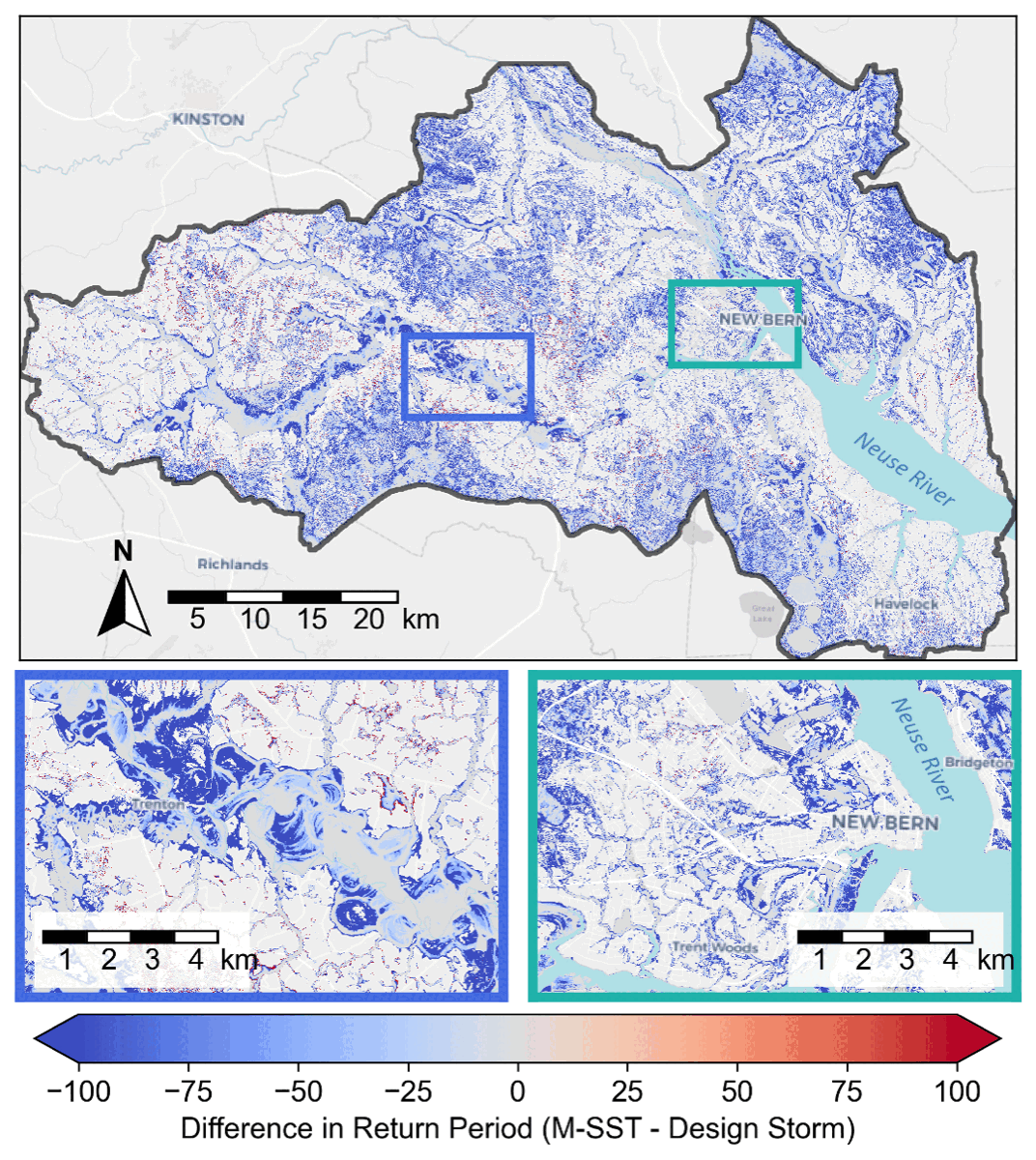
Using a coastal watershed in North Carolina, the study compares design storm-based estimates with those from stochastic storm transposition, a probabilistic framework that generates synthetic events with realistic rainfall fields. Both methods produce similar basin-averaged rainfall statistics. Even so, design storms underestimate flood inundation frequency by 31–35% and expected annual damage by 93% relative to stochastic storm transposition. These results show how complex storm-flood-damage relationships raise risk from smaller, more frequent storms, and they illustrate that accounting for spatiotemporal rainfall variability is necessary for accurate risk assessment.
Read the paper at doi.org/10.1038/s44304-026-00208-5.
For more details, see here.